A monsoon season defined by repeated red alerts
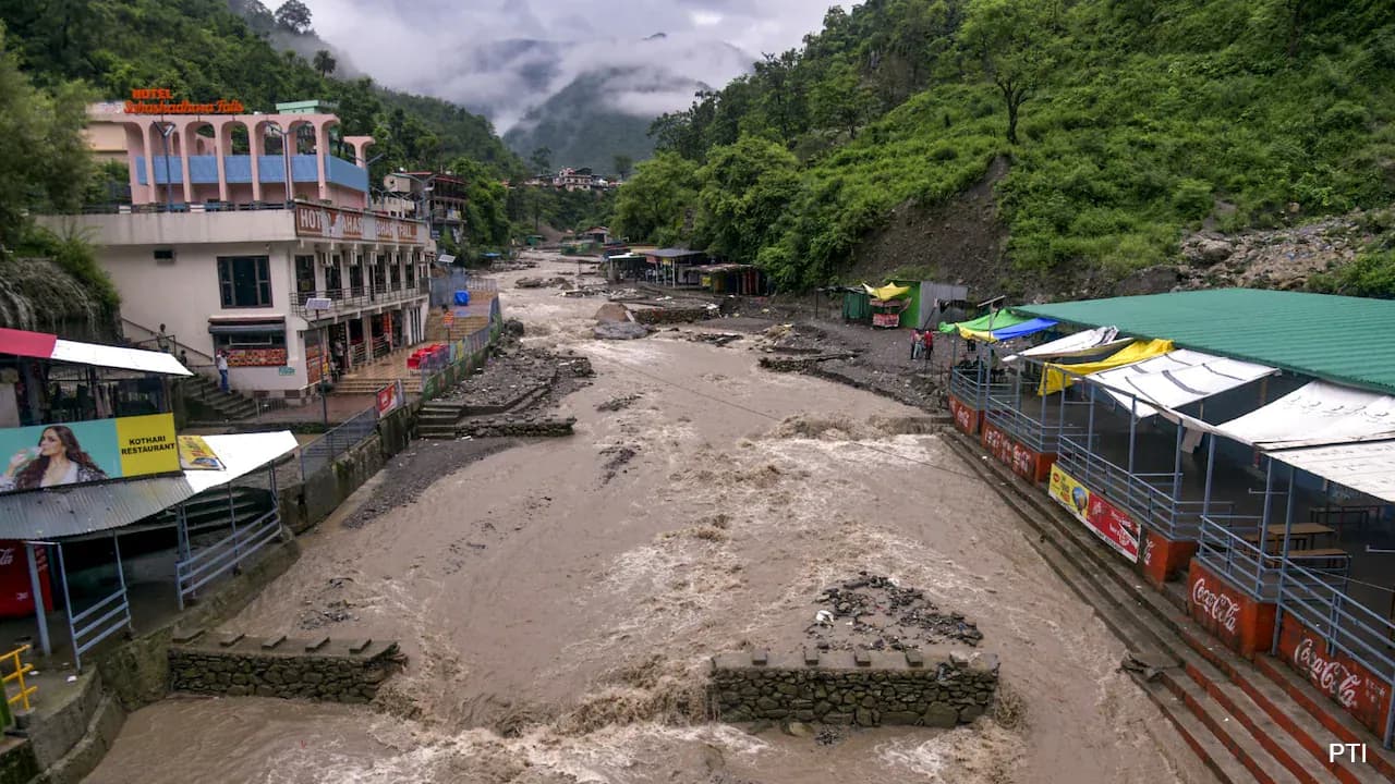
Uttarakhand has faced an unusually persistent run of severe weather warnings this monsoon season, with red and orange alerts rotating across districts including Dehradun, Pithoragarh, Bageshwar, Nainital, Tehri, Pauri, Haridwar, Udham Singh Nagar, and Champawat on a near-weekly basis since late June. Rivers including the Ganga, Yamuna, Alaknanda, and Mandakini have repeatedly approached or neared danger levels, road closures have run into the hundreds at various points in the season (180 roads were blocked in one late-June episode alone, including national and state highways), and school closures have become a recurring precautionary measure across multiple districts. The India Meteorological Department's Dehradun centre and the State Emergency Operation Centre have kept district magistrates on continuous high alert, with quick-response and rescue teams held on standby throughout.
Why this isn't 'just monsoon rain'
The characterisation of this season as involving genuinely extreme, compressed rainfall events rather than typical monsoon patterns is well supported: single-location rainfall totals of 150–200+ mm within a day have been recorded repeatedly this season (Kashipur alone recorded 206mm in one 24-hour period during a July episode), a rate of accumulation capable of triggering flash floods and landslides even in terrain that handles ordinary monsoon rainfall reasonably well. Cloudburst-linked incidents — including one near Silai Band in Uttarkashi district that left workers missing — underscore how quickly these intense, localised rainfall events can turn dangerous in the state's steep terrain.
A correction on the GSI landslide-risk figure
The claim that "18% of Uttarakhand" is in a high-risk landslide zone doesn't precisely match the figures found in current GSI-based reporting, though the state's risk is genuinely severe by several other measures. According to the Geological Survey of India's landslide inventory — based on a detailed survey covering 39,009 square kilometres of the state — Uttarakhand has 14,780 identified active landslide zones, of which 22% fall into the "highly sensitive" category (above the 15% national average, though below Himachal Pradesh's 26%). Separately, an independent national-scale academic susceptibility mapping study published in Scientific Reports found that 44.1% of Uttarakhand's land area falls into the "very high landslide susceptibility" category under one modelling approach, while other public-education sources citing broader vulnerability assessments have described up to 50% of the state's land as "very highly susceptible." None of these figures precisely match "18%," and they measure different things (share of already-identified landslide zones vs. share of total state land area), so it's worth confirming the specific 18% figure against a named, dated GSI report before publishing it as a direct citation.
The human factor GSI officials themselves highlight
On the causes, the video's framing is well aligned with GSI's own public statements. GSI officials have directly attributed part of the worsening trend to human activity, stating that "deforestation in the name of development, coupled with construction in vulnerable areas, has aggravated the problem," and noting that new infrastructure projects continue adding pressure to already fragile slopes — with GSI identifying 80 to 100 new landslide zones on average every monsoon season. Areas with extensive infrastructure development have recorded some of the largest new landslide zones, and these slides frequently block national highways and key connecting roads, compounding disruption during the monsoon months. Rudraprayag and Tehri Garhwal have been identified via satellite data as among the state's most landslide-prone districts specifically.
What officials are advising
The consistent guidance from meteorological and disaster management officials throughout this monsoon season has been to avoid non-essential travel in the hills during active alert periods, stay away from riverbanks and known landslide-prone stretches, and follow real-time updates from district administrations rather than relying on fixed travel plans. Given how quickly conditions have shifted between alert levels this season — sometimes within the same week — that caution applies especially to anyone planning travel to pilgrimage routes or high-altitude districts before checking the latest IMD bulletin.